
Kawakawa Shared MTB & Walking Track Map (K2K)
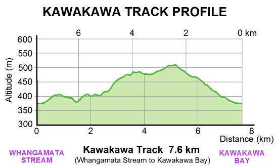
Bike Taupo has upgraded a shared MTB and walking track between Kinloch and Kawakawa Bay (blue line). The track continues on for another 10.5km via the Great Lake Trail to a carpark at Whangamata Road.
Click here to see the Great Lake Trail map
Page Last updated: 17 July 2012
Visitors: